
My eyelids are half shut as I sit here compiling my notes from the West Coast Trail, which I just returned home from this afternoon. There was very little signal on the trail to blog, so I’m bombarding you with a rundown of the entire trip in one long simplified regurgitation of the events that took place over the four days my friend Steve and I were on the trail.

You can check out my Gear & Clothing List, Food Menu, Budget, and FAQ & Considerations on the West Coast Trail drop-down under the Hiking Trails tab on this blog, plus my entire Photo Gallery in addition. I’m hoping this information will assist other hikers in planning their trip, and perhaps determine if they really want to hike this trail or not.

The trail can be travelled from north to south or south to north. We chose the later option (see FAQ for reasons why), but for whatever reason the kilometres on the trail and the map follow the opposite route, which means our trip counts down from kilometre 75.

Now get comfortable for some light trail reading…
Day 0 – Thursday September 10:
Vancouver to Gordon River (Via Nanaimo and Pachena Bay)
I was awake by 4:30am to catch the first ferry to Nanaimo (Departure Bay) leaving West Vancouver (Horseshoe Bay) at 6:20am. Steve drove, and during the trip on the ferry we were lucky enough to have our eyes open to see a whale swimming right beside us. We drove to Pachena Bay, the northern trailhead of the WCT (not Bamfield as first thought), to leave the car and catch the 1:45pm bus to Gordon River near Port Renfrew, the southern trailhead. We left ample time to reach our destination, knowing that the road after Port Alberni turns into 74kms of rickety unsealed logging road, slowing us down considerably. Upon arrival we met a young man who had just completed the trail, telling us how dreadfully awful his experience had been; how much it had rained and how badly the cable cars “sucked” amongst other things. We continued to ask him questions about the trail until his negativity became too much to bare, and we decided to speak to the parks people at the office instead. We got a map and a tide chart and boarded the bus alongside 26 odour-ridden hikers who had just finished the trail. They drooled over our snacks for the drive and I felt terrible having not thought ahead to provide a little trail magic along the way. (Note for anyone who wants to make 26 friends instantaneously and get the best seat on the bus). The bus ride down to Gordon River was mainly along the same logging roads we’d already travelled, but I somehow fell asleep for at least half an hour despite the window rattling right beside my eardrum. The bus driver actually said the road was in the best condition he’d seen it in a long time because a grader had just been through, so I’d hate to have seen it before.

Steve and I camped at Gordon River at the Pacheedaht First Nation campsite, where a few sneaky crows got into our bag of Doritos and tortillas after turning our backs for 30 seconds. We took a walk along the gorgeous stretch of coastline during happy hour, ate cold pre-made pasta for dinner and made a small fire on the sand. The women camped beside us offered up a bowl of quinoa salad with strawberries to go with the pasta and two slices of lemon loaf for dessert. As the sky turned black and the stars took centre stage, I headed for the outhouse just as my headlamp completely conked out. I was left disoriented and lost in the forest, having to backtrack to our campsite via the other campfires along the beach. It’s going to be an interesting trip without a headlamp that’s for sure, but I’m feeling pumped for Day 1. Orientation is at 10am and the ferry departure across the Gordon River is at 11:30am. Let the trail begin!

Gordon River to Camper Bay (Km 75 – 62) – 13kms
Today was LONG!!! Everyone had said getting to Camper Bay at km 62 was going to be tough, but we were determined to go more than 6km past the first campsite at Thrasher Cove on Day 1, ensuring smooth sailing for the rest of the trail in the 5-day timeframe we allocated. We woke to a glorious sunny morning on the beach on the Pacheedaht Reserve (though our tents were soaking wet), and I was in a t-shirt and already putting on sunscreen by 9:30am. We arrived at the mandatory orientation just before 10, and after having been a little cynical about the whole affair, I actually found it extremely informative. It was like a mini kick-off weekend for the PCT, covering trail conditions, water sources, expected wildlife, weather, safety and emergency procedures.


The 6 minute ferry across the river then dropped 12 of us at the start of the trail and we were off – with Steve and I leading the pack, meaning freedom to climb ladders at out own pace without waiting for others ahead. Good move!! We reached Thrasher Cove in 3 hours as opposed to the suggested 5 (because of the amount of ladders and technicality of the trail), and after a quick lunch were in a perfect tidal scenario for the beach walk. The bouldering along the shoreline however was absolutely intense, literally seeing us climbing rocks and over logs for the first 1.5 hours along the beach. I’ve never had to climb or do so many dead lifts with a forty-pound pack on my back. A bottle of Gatorade by a small waterfall got me back on my feet for the second stretch, which was fairly forgiving except for a sketchy crossing across a small inlet (Owen Point – km 67), where we had to climb across rocks with a coating more slippery than ice, then hoist our packs onto a huge boulder and clamber up behind them. This is where the onslaught of scrapes and bruises began.


At ‘Beach Access A’ (km 65), we returned to the trail for the last 3kms of the day, hiking over slippery roots, through mud holes, negotiating log crossings and dank, dark conditions. This stretch (km 65 – 62) was excruciatingly poorly maintained, taking us almost three hours to complete at a pace of 1km/h. But the first cable car over the river to our campsite by the beach put a smile back on our weary faces.


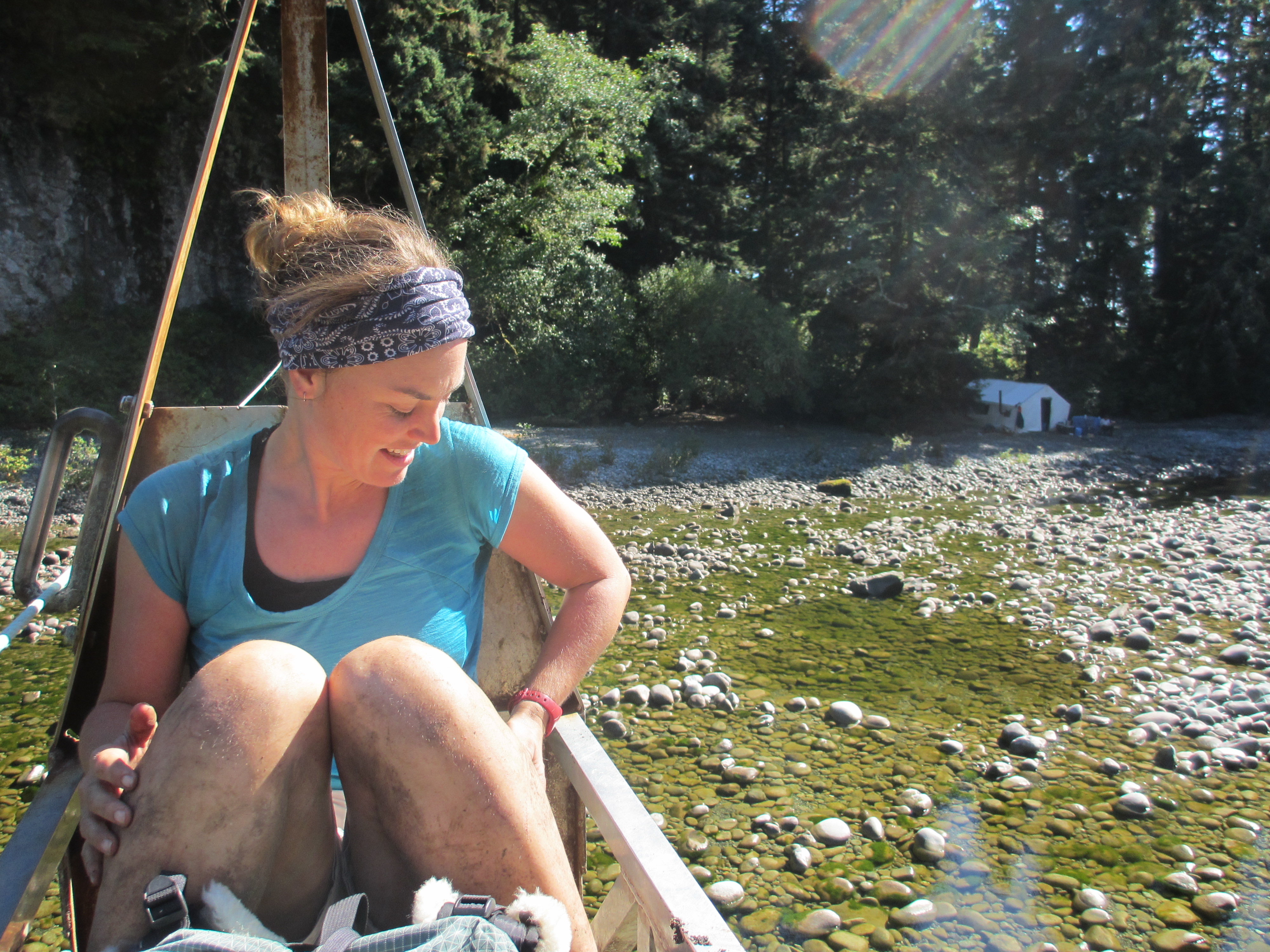
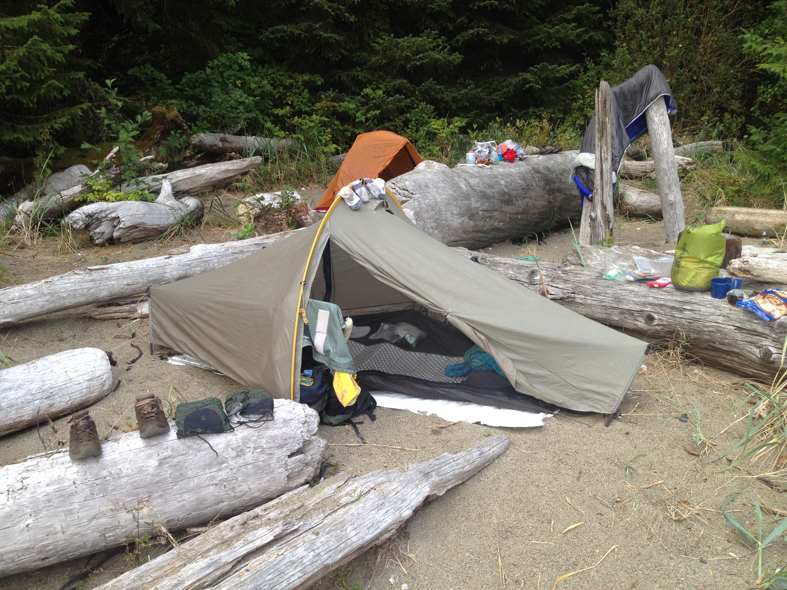
It was already getting dark by the time we set up our tents, and without a headlamp I was using a lantern we had packed last minute to collect water and firewood. While Steve prepared pre-cooked rice with mushroom soup and tuna, I lit a measly fire, then gobbled down the food, changed clothes, cleaned the pots and pans, took the food to the bear bin, brushed my teeth, and am now in bed at 10pm. No one else that started today made it to this campsite, and everyone at camp was surprised I was still smiling after such a long haul. It felt like the longest 13kms I’ve ever hiked, and I certainly wouldn’t recommend this strategy to others, unless you do the orientation the day before and get an early start, or you’re really strapped for time and are prepared for a good 8 hours of tough hiking on Day 1.

Day 2 – Saturday September 12:
Camper Bay to Bonilla Point (Km 62 – 48) – 14kms
Another long day. I feel like I’ve been on the trail for about four days already. One kilometre on this trail is like three on any other trail I’ve ever hiked. When they say it’s technical they certainly mean it. Almost every step today seemed death-defying; whether balancing on narrow slippery logs across certain death falls, climbing and descending 200 feet of ladders, some of which were lopsided, balancing on tree roots to avoid swimming in mud, or navigating over seaweed covered rocks at low tide, concentration was the name of the game. One misplaced step and you’re snapping a limb or two.


 The day began with a ladder climb out from Camper Bay, followed by 4km of mud and root infested swamp path, more ladders, cable cars and suspension bridges. I would not want to be a first time hiker on this trail; I think I’d be looking for a way off after today’s challenges. A smart couple took a non-listed beach walk this morning at low tide saving them hours of hell from Camper Bay to Cullite Creek (or at least I think that’s where they re-joined the trail). Had we known more about it we would have done the same and saved some agony. We saw the couple depart camp in the morning and then passed a group of guys heading south who said they’d seen them two hours before. One of the guys (Dave) recognised me from the store having served him two weeks ago. I showed him my mud soaked, non-waterproof shoes, and he laughed because I hadn’t taken on the advice I’d given to him. I also passed a girl today at Walbran Creek who actually asked if I had brought along gaiters. I looked down at my legs and told her I was wearing them. I guess they’re so short you can almost mistake them for socks, and they basically looked like extensions of my mud caked legs anyway.


Reaching Walbran meant the end of the hardest section (so they say), so we celebrated with pre-cooked wieners and cheese for lunch and a well-deserved rest. I also got to wash the mud off my legs (which I was a little hesitant to do but Steve insisted!).
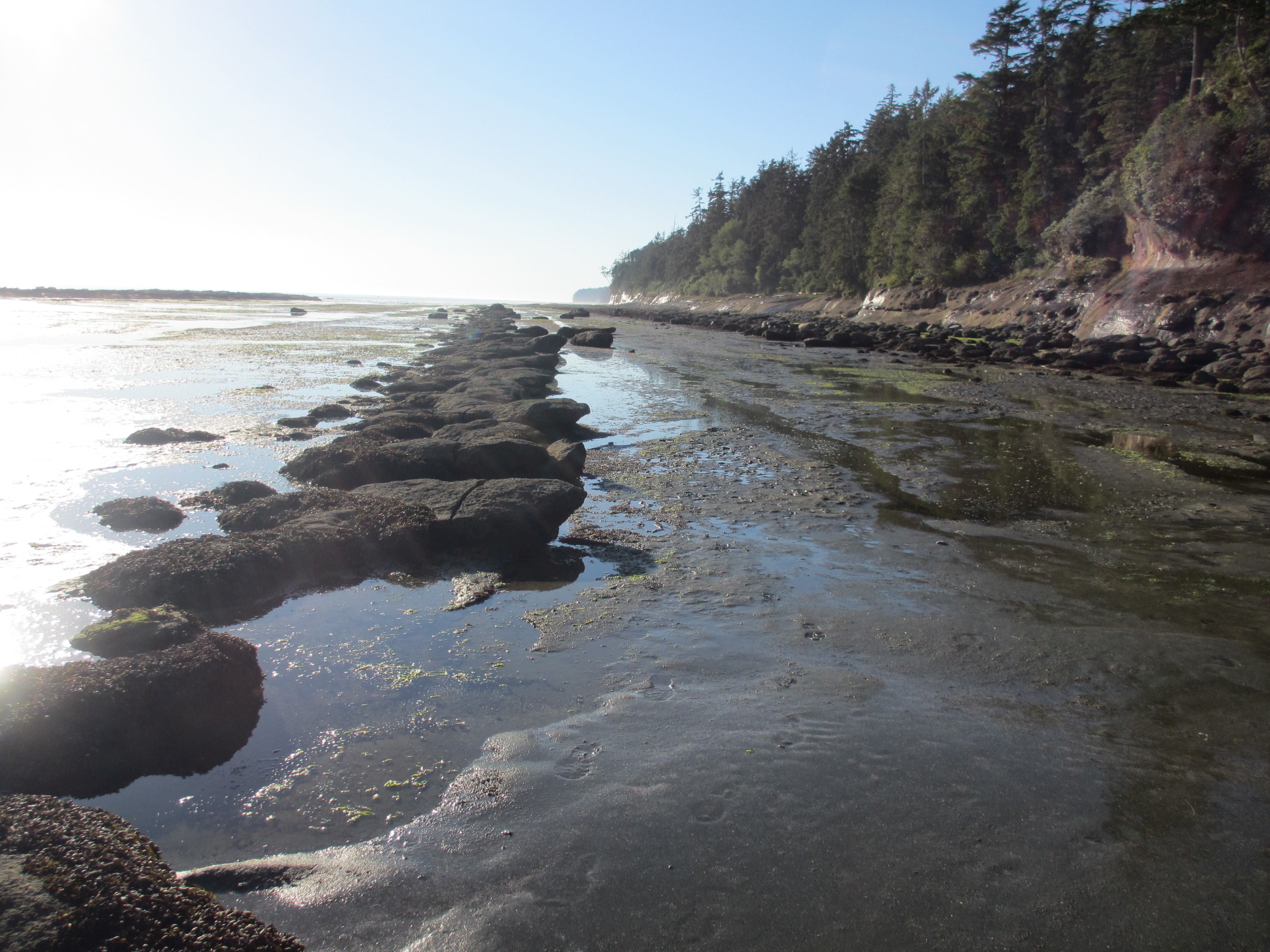
Walking on the beach for the last 5kms was like heaven compared to the start of the day, but sinking into the small pebbled sand meant hiking was a hard slog, so we decided to risk slipping on the seaweed covered rocks instead. The conditions of the beach seem to change as quickly as the trail. One minute you’re steamrolling over hard packed sand, and the next you’re trudging through Helsinki (our new term for deep soft sand).


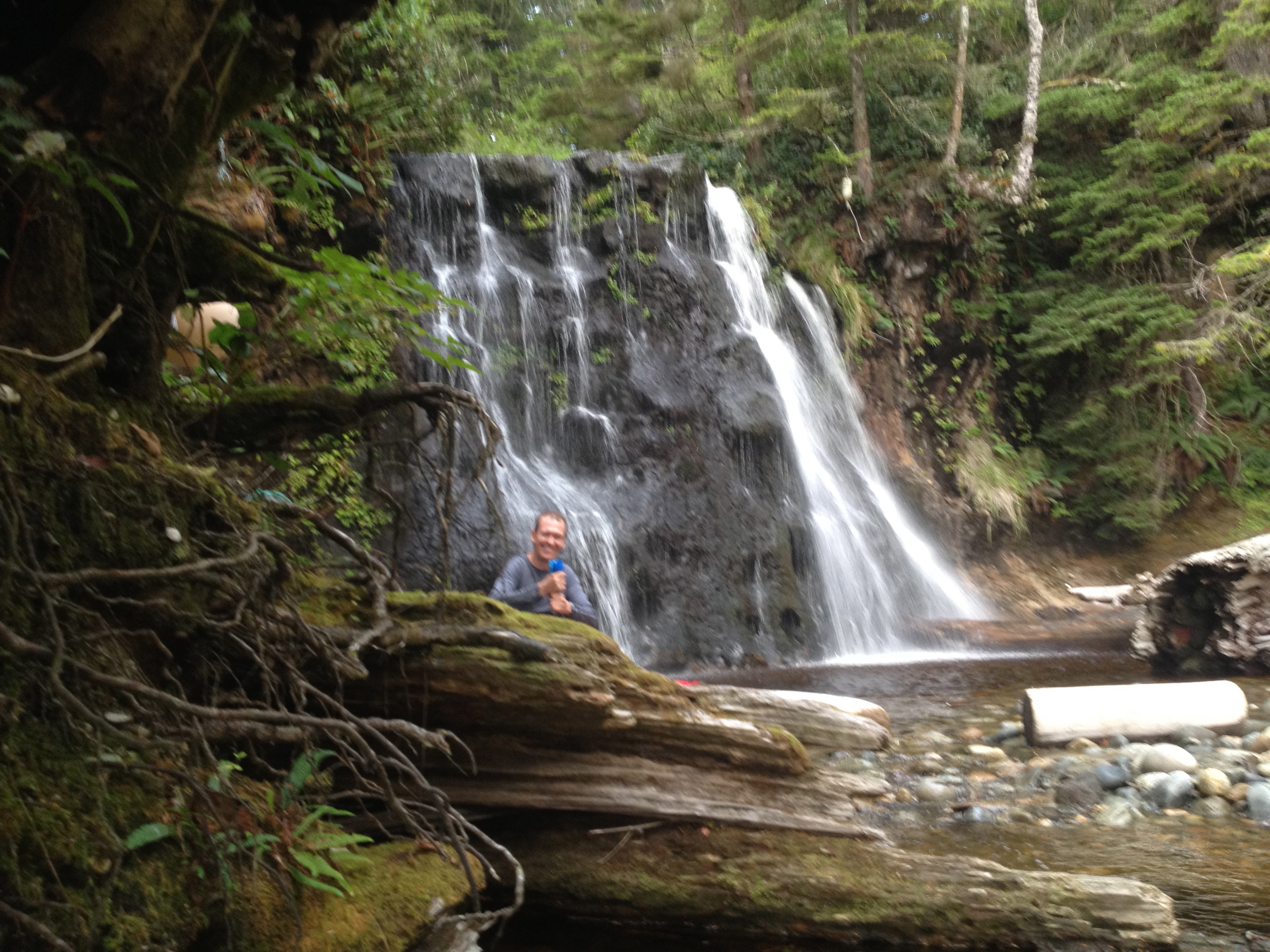
The campsite tonight at Bonilla Point not only has fresh water, it’s streaming down from a 30-foot waterfall. We also witnessed the most brilliant sunset along the beach, and are enjoying the sound of the waves mixed with the waterfall behind us. I’ve been appointed dedicated fire chief for the trip, but was disappointed when my campfire refused to ignite, and when it finally spurted a few flames, I had to re-coax it into life every second. Steve has adopted the role of chef, preparing an amazing dinner of pasta, tuna, tomato and olive sauce, with grated cheese that had melted into one giant clump. After dinner at 9pm we were both absolutely ready for bed.

Before I got into my tent I crept off into the bushes for a quick pee and was surprised at how nervous I felt about cougars and other animals in the dark away from camp. I honestly felt like something was behind me and practically raced out of the bushes before even pulling up my pants. I was never this scared alone on the PCT, even after my encounter with a cougar, so I’m not sure what’s up with that. Maybe the orientation put me on edge, but it’s pretty unusual for me to be scared, especially with lots of other hikers around.
It’s now 10pm and I’m off to sleep. We’ve got an early morning tomorrow to beat high tide and ensure as much beach walking as possible. Over and out from Bonilla Point.
Day 3 – Sunday September 13:
Bonilla Point to Tsusiat Fallls (Km 48 – 25) – 23kms
Today was another long haul with a perfect seafood sanctuary in-between. We woke at 6am to time the tides and were on trail (the beach) before 8am. The open sand was glorious compared to the rugged muddy roots and twisted trail we’ve been used to, so we wanted to take full advantage of every beach stride while the tide was in our favour. The first cable car slowed us down considerably with the old rusted pulleys barely moving across Carmanah Creek, and even though we both yanked on the rope, the final heave up to the other side was a painful one.


We were getting close to the tide cut off point, but with only 2 kilometres to go figured we could hustle and still make it. After scaling a huge rock face to get around the first point, we were met by a small boulder field and then another long beach stretch before the final scramble out. Having thought the worst was over, when the trail met the beach again we stopped for a small snack and then carried on, only to find ourselves scaling a wall of slippery rocks (km 37.7) that saw Steve slide into the ocean and me clinging to the rocks like a cat. Steve managed to climb onto the other side rescuing me from certain submersion, just before a couple behind us encountered the exact same problem. I guessed the guy from Germany (Christian) had barely backpacked before, as the stabilising straps on his pack were completely loose. When I showed him how to tighten them, his face expressed a mixture of gratitude for the pain relief, and disappointment that his shoulders had suffered so many kilometres up to that point.


Earlier in the day when we reached the infamous burger shack we’d heard so much about at km 44.5, we found it closed, as the woman who normally runs it had recently been taken to hospital. The guy who was there named Irvin asked for our help to move a boat above the shoreline, and in return offered us anything in the store for free. Steve took control at the bow, pulling on a rope and directing three men plus me to drag the monstrosity over logs and out of harms way of the tide. We didn’t end up taking anything from the store as our packs were still laden with snacks and food, but it was nice to lend a hand and talk to Irvin about his life and experiences along the trail over the many years he’s lived here. He also told us there were approximately 2 kilometres of ladders to climb in total. (Not exactly what we wanted to hear!)

At Nitinat Narrows (km 32.5), you have to catch a small boat that takes you across the river, running between 9:30am and 4:30pm. We timed the stop perfectly for lunch at the crab shack, which cooks up fresh seafood straight from the river. The German guy Christian and his wife Jennifer joined us at our table, plus another guy and girl from Alberta. They ordered the crab, while I chose the fresh salmon that had literally been plucked from the river and seemed a lot easier to eat than shelling crab.

Nitinat Narrows is the only evacuation point along the trail, and there were three people planning to leave that day, including a guy we’d passed who had sprained his ankle. We also met a woman with a swollen black eye who had fallen flat on her face on the rocks. I’m actually surprised I haven’t seen more injuries, and am relatively still in one piece.


 Hiking the final 7.5kms to Tsusiat Falls straight after a late lunch on a full stomach was tough, especially since we were faced with walls of mud and more twisted roots again, but it was well worth the repercussion. The girl from Alberta had drunk two beers at the shack, so no matter how bad I felt; I knew she must have been suffering from the slippery slides of mud a lot more.

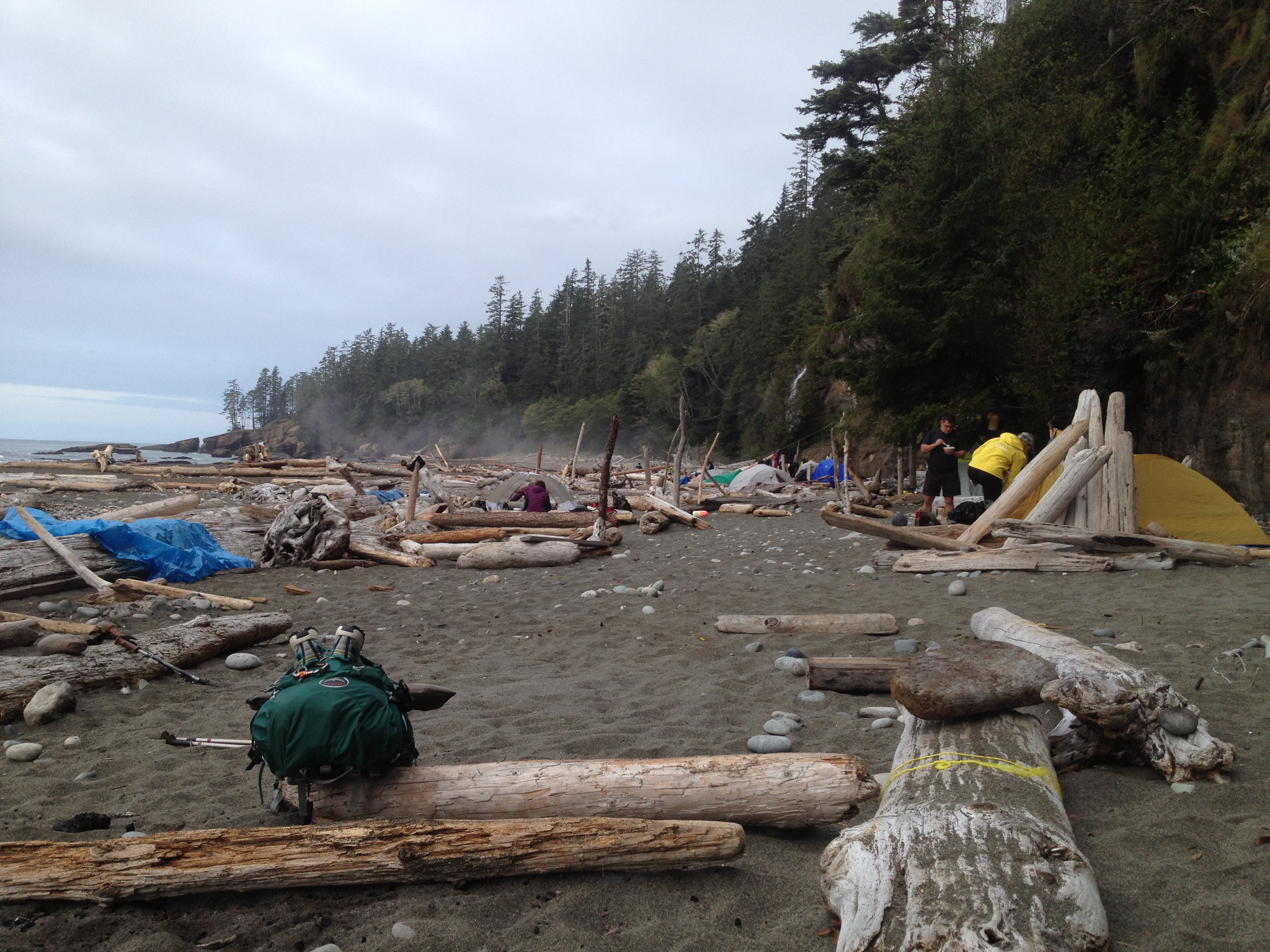
Arriving at the campsite was like walking into a city lined with tents, due to the distance between sites at this stage of the trail. The bear bin was filled to the brim, and although I doubted any bears would visit with so many people around, the mice were running rampant, and had already got into Steve’s trail mix the previous night. We camped beside a couple of Australians from Brisbane who now live and work in Jasper, and I enjoyed their familiar accents though they certainly made me homesick. The girl Nay, (short for Naomi), chatted to me while I filtered water by yet another spectacular waterfall, then we took advantage of their campfire and marvelled at the thick blanket of stars until it was 9:30pm and already time for bed.

Tomorrow the weather is forecast to turn, so we might just book it to the end of the trail depending on how our bodies are feeling.
Day 4 – Monday September 14:
Tsusiat Falls to Pachena Bay (Km 25 – 0) – 25kms
It might have been the forecast of rain on the cards or the fact we were so close to the end, but today we were raring to go. We weren’t alone in this endeavour as the folks from Alberta had the exact same plan in mind. We woke at 6:15am and left camp at 8am, delayed by a long line-up at the one outhouse for about 50 people. Ladders were first up to climb up out of the beach, and then the regular muddy rooted trail followed. We hit the first beach access after 2.5kms, but by then the trail had improved, so we decided to take the high road rather than slogging through deep pebbled sand. We leap frogged the Albertans on a number of occasions, but left Christian and Jennifer at the final camp site (Michigan – km 12), because they were reliant on catching the bus back to their car at Port Renfrew, and were unable to make the 1:45pm cut-off (a very good reason to leave your car at the end point of the trail).

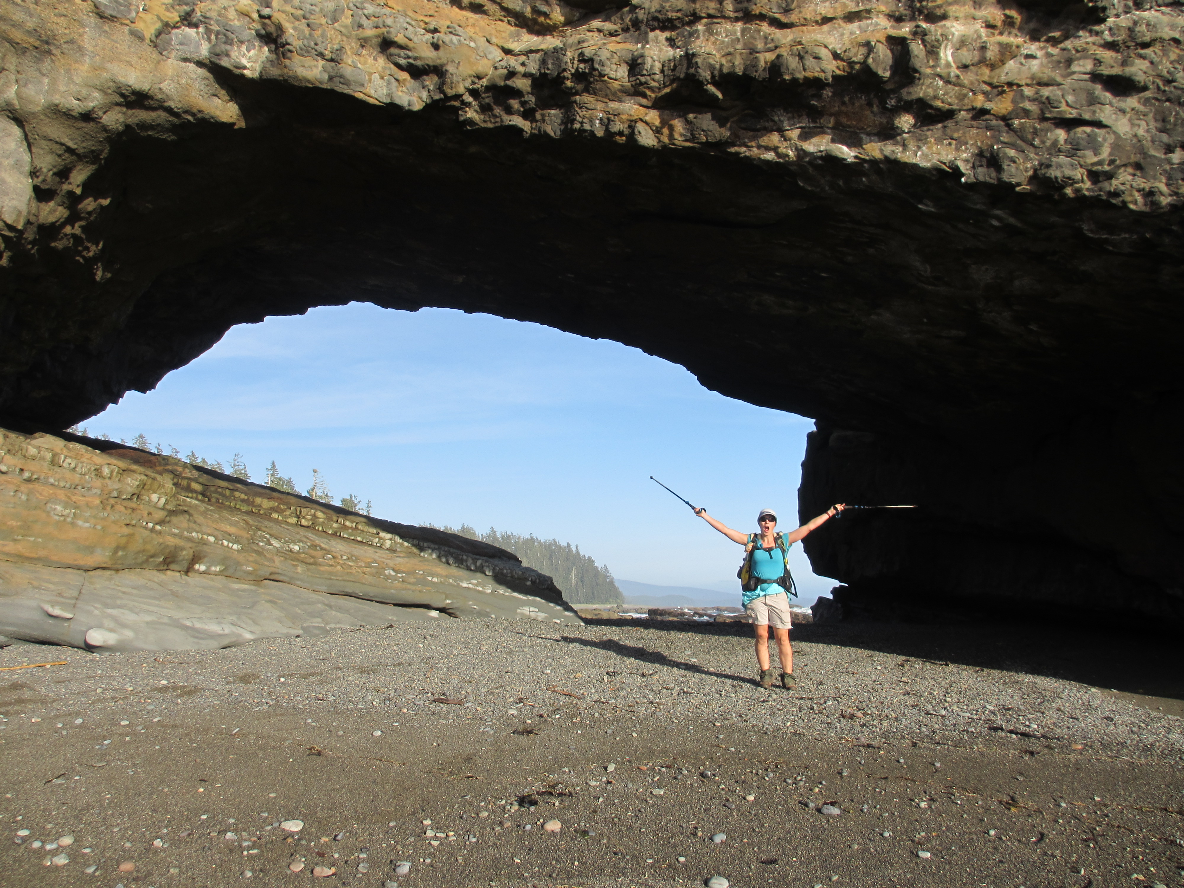
There were 2 kilometres of beach only hiking between km 14 and 12, which presented mainly Helsinki conditions, apart from some log and rock hopping that got us out of the sand bog. Rumour had it since the beginning of the trail that the final 12 kilometres were a cakewalk, but after being disappointed for the first two, we discovered the best trail actually began at km 10, and were able to polish off the final leg at a 4km/h pace. We passed a train of people beginning the trail at about the 5km mark, and couldn’t help but cringe at some of the challenges they’d have to face in the rain. They all had smiles on their faces and looked fresh, so we simply wished them happy trails and good weather. Not far from the end we also passed a couple of day hikers, one of which immediately recognised me from my blog. I was surprised he knew me in an instant, but said I was wearing the exact same kit as I usually do (which is true), and even Little Muk Muk was strapped to the front of my pack. I hope you had a great hike to the sea lions Gunnar!


For the final 2 kilometres we tried out the beach route, but high tide forced us back onto the trail, presenting us with at least six more ladders and a small climb and descent. The trail wasn’t quite finished with us yet! At 5pm we reached the trailhead at Pachena Bay, where we’d been only four days earlier, taking our first swim for the trip in the freezing cold ocean and celebrating our achievement and the fact we’d made it unscathed!

I only fell twice during the trail, one time rolling my ankle and the other sliding onto my side in the mud. I’m absolutely shocked that neither Steve nor I suffered worse injuries, and I’m absolutely dumbfounded that so many people successfully hike this trail every year. If I had to sum up the trail in just a few words, I would say it’s technical and challenging, with an abundance of rugged coastal scenery. I would not recommend the West Coast Trail for beginner hikers, young children or anyone with existing injuries or a fear of heights. If you’re fit; strong enough to climb with more than 40 pounds on your back, prepared to get wet and muddy and are up for a true challenge, then this is the trail for you!
Be sure to check out my FAQ and Considerations if you’re considering to hike the West Coast Trail.

Gotta admire the way you handled this trail – if that is a proper description of what sounded like a path to hell. You’d be hard pressed to take in the ambience while looking for the next step. Won’t be putting this on my list but for the variety of challenges it clearly delivered achievement and satisfaction for you both. What’s next?
Good question Rex! My friend Martin said my life looks like one long school camp at the moment haha! No big adventures planned for the remainder of the year except staying out on the water and paddling!
Great post! I don’t see how anyone does those ladders. My vertigo kicked in and I almost fell out of my chair!
Haha I agree! In the rain I’d be clinging to those things for dear life! It takes a great amount of strength to climb 7 ladders in a row with more than 40 pounds on your back. I’m baffled at how everyone does it !?!
Whoa….that trail would certainly have “kicked my butt” for sure….Now, I can only imagine the beauty and the tough challenge it was…..
It seems writing all the that you did…and all the pictures to add to the blog….would be hard to do…but you always come through and help us to “see” your journey…..Thanks for sharing, sweetie….
Like on the PCT, the biggest sacrifice blogging requires is sleep time. I actually look back and wonder how I ever survived on less than 6 hours sleep day in, day out. But it brings me such joy to share the experience with people who may not have the opportunity to hike it themselves!! It’s a pleasure! 🙂
Congrats to finishing the trail! 😉 even though you guys were pretty much done when we met. It was so nice meeting the person behind this awesome blog. I wished we could have chatted a bit but I was good we hurried on, as we just made it back to the car in last daylight and with only one bear encounter on the trail 😉
It seems you had just as awesome a time on the wct as I had last year(which I bought the tarptent for, after reading your pct blog 😉 )
I’m glad you guys made it back just before dark! It did seem to sneak up quickly and we wondered if you guys would cover the distance in time. It’s great that you got to see a bear too! Thank you for following the blog and for your kind words. It was great to bump into you!
Isn’t hiking supposed to be fun?? You are my blogging mentor. South Africa trip begins this Sunday!
It’s often the experiences around the hiking that make it enjoyable. The star filled skies, the sunrise and sunsets, the simplicity of living in nature, the lack of distractions from electronic devices, the people you meet and share your experience with, and so much more! Carrying a 40 pound pack is only fun for the first 5 minutes! Haha!! Have a wonderful trip Susan!! 🙂
Hey Rozanne! I think you are about nuts! Lol!!! In the best-est of ways! 🙂 Thanks for all the fun I’ve had in the past three hours reading, youtubing and websurfing until my eyes are burning! Taking in as many of your adventures as I could find. 🙂 Won’t you consider the Washington Coast, from Teawhit to the Columbia? I need a partner! Maybe yet, even, if we get the infamous PNW Indian summer. Or just come to Seattle for a visit and some adventure! I’ve got a spare room! 🙂 🙂 🙂 Carl
Haha thanks Carl! I’d be tired of me after three hours! 🙂 No plans to leave Canada at the moment but I wish you well for your upcoming adventures!! I definitely miss the awesomeness of Washington!
Lol. I am exhausted! Welcome any time. 🙂 email me
Serious question this time… After a few days off, I went looking for some more of your pct documentaries, then wondered: is possible to view them chronologically? Can you link me to the start and I can follow them as they were posted? 🙂 gracias!
CVS
Hey Carl, I guess you can start back at my first post from the trail and follow the journey from there: https://mexicotocanada2013.wordpress.com/2013/04/15/were-on-our-way/ You may need to set aside a few days if you’re planning to run through it all! 🙂
Thanks Rozanne! We’ll start with a shorter hike, then work our way up! And I gotta say, I found the mtn lion one, I had a similar in Montana once, and could actually feel that moment all over again. 😦 Now I just can’t go into cat land without something a bit more substantial than an eensy weensy. 🙂
Muk Muk it’s good to see you back on trail. Well written and enjoyable read as always. Seems like you did more ladders, bridges and cable cars than actually hiking this time around. Look forward to reading about your next adventure.
Thanks Derrick it was great to be back in nature travelling through such rugged and spectacular terrain! I’m glad the PCT didn’t have ladders like that, it just regularly plonked 3000 foot climbs in my path!!